Today I will please fans of industrial landscapes - we'll visit a dam
connecting Kronshtadt with northern coast of the Finnish gulf.
The dam has been creating (construction goes very slowly nowadays, due to the
300-anniversary of Petersburg, though talks activated) with two purposes:
1. Protection of Saint Petersburg against flooding.
2. As a part of a belt line (to unload city from autos, especial
lorries which go now through the historical center). The dam should
connect southern coast of a gulf with northern (Oranienbaum with
Gorskaya) through Kronstadt.
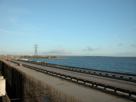
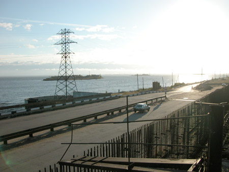
Now there is only a part of the road Gorskaya (near to St.-Pete, on
Primorski highway) - Kronstadt. And it should be strongly expanded and
strengthened. Look at the width of the future "city ring".
It is interesting, that field-marshal B.Minih in 1727 already
suggested to build a dam.The system of dams with 4 meters height
should fence each island and entire city.
In XIX century P.P.Bazen has
developed the project of a protecting stone dam. Other offers existed also.
The current project has been developed by 1978, with the help of 66
organizations-participants.
From the beginning of construction (1979), and especially during
"Perestroika", were a lot of talks about infringement of ecology after
construction of a dam (water stands, seaweed excessive growth, etc.).
In 1990 construction was stopped.
However, solving a problem for a long time is not obviously possible,
the case is complex and profitable - experts are involved with both
parties.
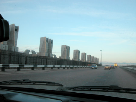
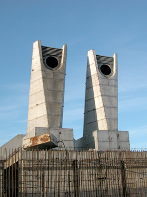
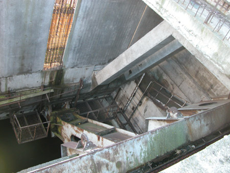
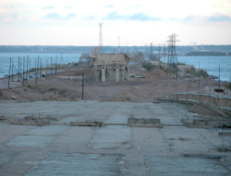
It as far as I understand, there should be sluices.
Here (as, however, in other places of a dam) they like to film
commercials and videos.
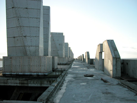
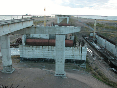
It is possible to climb on the top of a sluice. To tell the truth, one
of them is equipped with a dog, moving on a wire along all sluice
(so-called "ryskalo" (ransacker)).
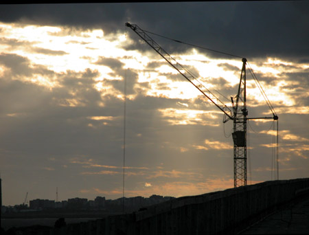
Deserted constructions inside.
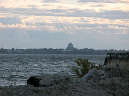
One can see Kronstadt far there(a dome of the Sea cathedral).
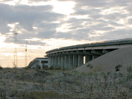
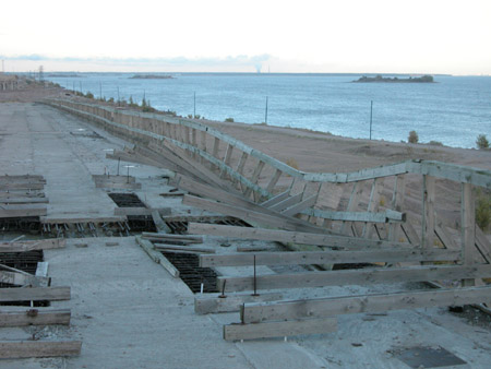
The second known object on a dam - a viaduct " into nowhere ".
Maybe we will climb there.
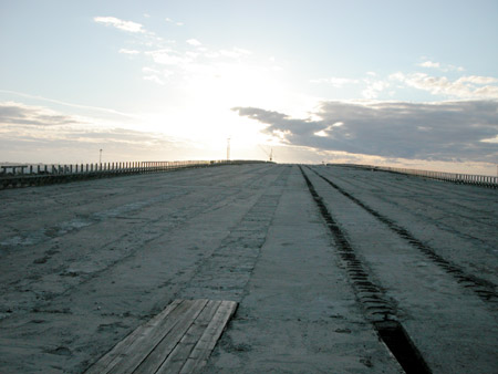
It should be quite wide way here. Even under the project of soviet
times - 6 rows, with the common width of a dam of 30 meters and
height of 8 meters
For people not to fall downwards a wooden fence was built. But it was
a long time ago:)
Behind the second disassembled viaduct is seen.
This place is under construction. Rather highly, though on a picture
it is not so obvious.
Let's finish walk by the citation from " the Guidebook across
Leningrad " published in 1933 :"
At last, Leningrad in 1937 any more
does not have a possibility of a flood threatening him since 1703.The
built giant dam from Oranienbaum up to Kronstadt and from Kronstadt
to the Lisiy Nos meets sea waves, takes up its impacts, detains, does
not admit it to Leningrad, and the water does not break and does not
flood Leningrad. On dams with bridges the circular railway is built,
connecting Kronstadt with Leningrad and both coasts of a gulf ".
Apparently, they had heavily missed with the construction terms :)
To learn more in detail about a history and purpose of a dam, about a
problem of flooding in Peter visit the following link
(in russian).